Engle Lake: July 31-August 2, 2019

Trip Info

Trip: A three-day, two-night backpack to Engle Lake in The Cabinet Mountains Wilderness, with Dave, a former Libby High School classmate and Loggers-football teammate.

Location: Cabinet Mountains, Sanders County, Northwest Montana.

Drive: From Libby, Montana, drive US Highway 2 westbound 15 miles to junction with Montana Highway 56. Turn south onto 56 and continue 35 miles to Montana Highway 200. Turn east on 200. Drive approximately 4 miles and turn left (north) onto Rock Creek Road 150 and keep right at road forks until you reach FS Road 2285. Turn right onto 2285 and continue 7 miles to the end of the road and trail #932.

Hike: Trail #932 to Engle Peak and Engle Lake. Three and a half miles to the lake, but much more difficult than you'd expect given the short distance. We didn't go to the peak.

Notes: There is no water from the trailhead to the lake. The trail begins with a relentlessly steep climb for the first mile and a half to the top of a ridge where there is a sign marking the boundary of the Cabinet Mountains Wilderness. It follows the ridgetop for another mile or so with occasional views of the lake basin, but then drops down the same side of the ridge you just climbed only to climb up it again and then drop down the other side of the ridge to the lake. The unnecessary ups and downs, the lack of water, an old burn area, and a steep downhill stretch over a talus slide as you approach the lake, make this hike perhaps as mentally challenging as it is physically.

continue, next column
Engle Lake: July 31-August 2, 2019

Day One

Dave's book said the trail gains 1500 feet in the first mile and a half. And there is no water all the way from the trailhead to the lake. It was only about a four-mile hike but the book warned it would take three to four hours. After a long drive to the trailhead we finally started hiking late in the afternoon. It was probably about 85 degrees when we set out.

At the trailhead, as I was still fiddling with my gear, and my attitude, Dave said he would go ahead of me because I'm faster than he is going uphill, and I'd catch up to him. Then he was gone. I felt my apprehension increase as I was suddenly alone.

I had gone on day hikes each of the preceding two days, and other than that I hadn't been hiking much at all this summer, let alone hiking with a full two-night pack. There is no water on the trail so I had packed more than enough, and I could feel the extra liters as I hoisted the pack onto my back. I cussed a little beneath my breath as I cinched up my waist belt, took a last look around the vehicle, and hit the trail.

The book hadn't lied: The initial climb was relentless. And the forest was featureless, except for the constant uphill slope and the rocks and the dust.

It was so hot I might not have made it to the top of the ridge without my secret weapon for hiking in hot weather: I had halfway filled my pack's water bladder the night before and put it in the freezer, then I filled the rest of it with water in the morning. On the trail, every time I thought I couldn't go on, I stopped and took a long pull of ice water. It literally enabled me to keep going.

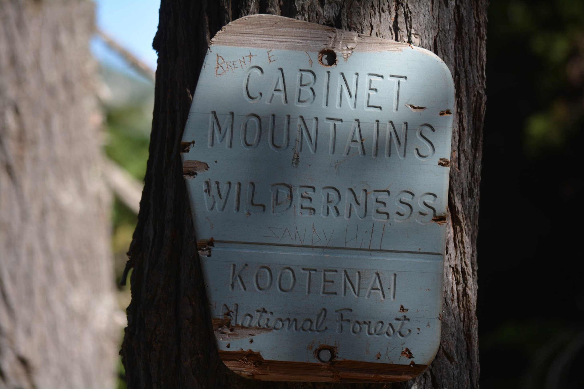
As I finally emerged from the woods at the top of the ridge I was greeted by an old friend: a Forest Service sign telling me I was entering the Cabinet Mountains Wilderness. Stopping there to catch my breath, I joyfully recalled many memories of past entries into this wilderness so near where I grew up, one of the 54 original wilderness areas created by the 1964 Wilderness Act. Today there are 765 federally designated wilderness areas in the United States.

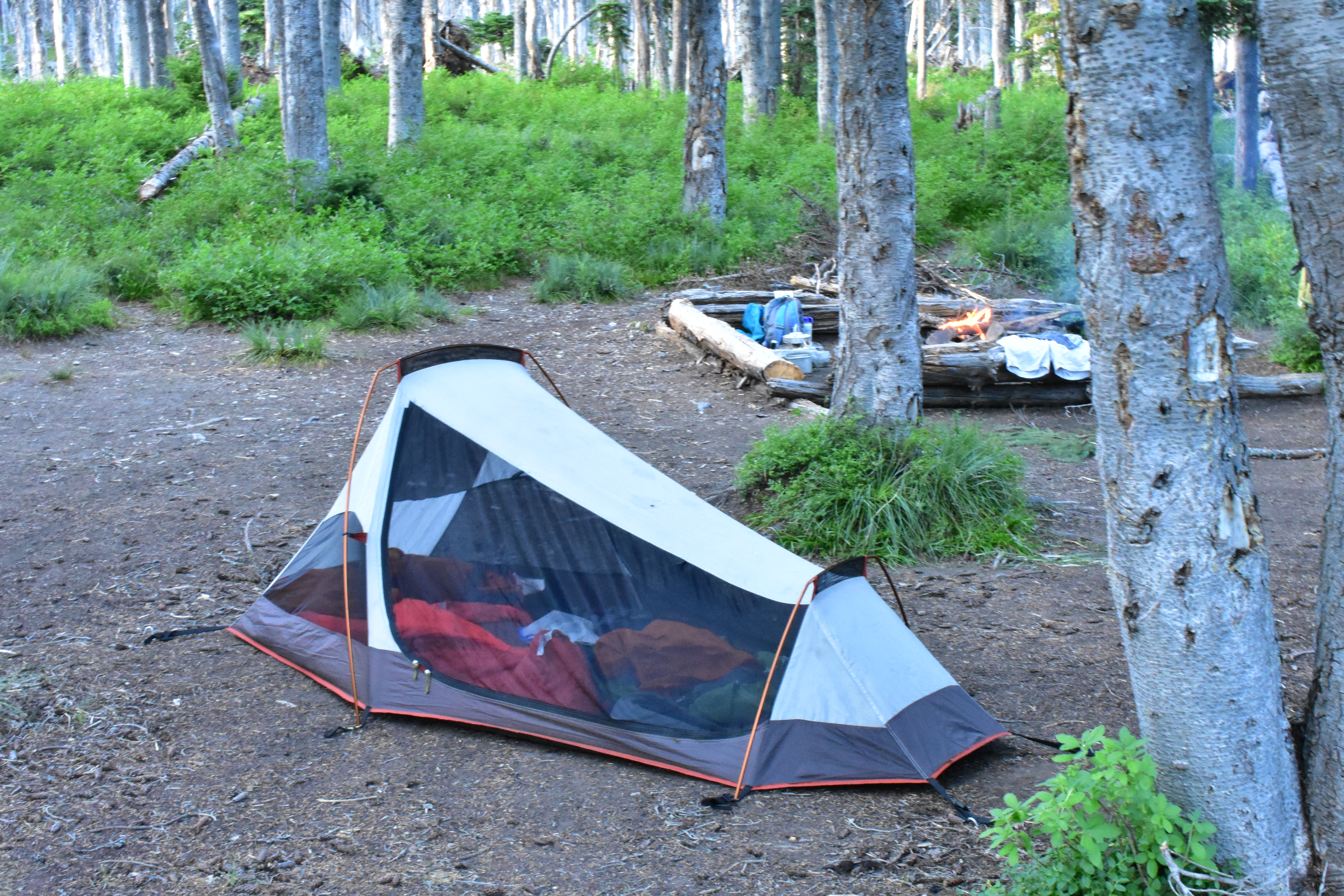
An old friend. (photo by Dave)

continue, next column
x

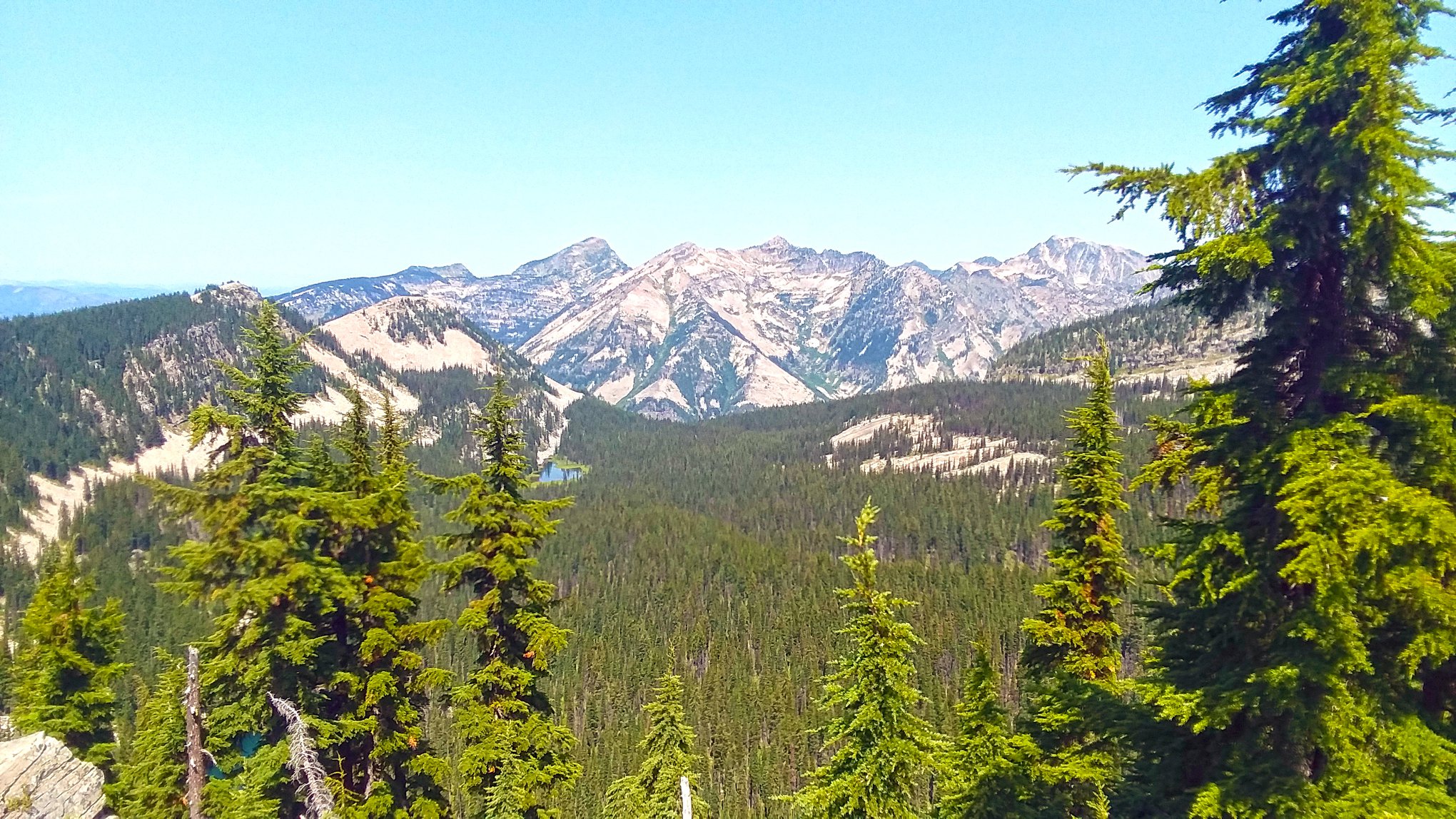
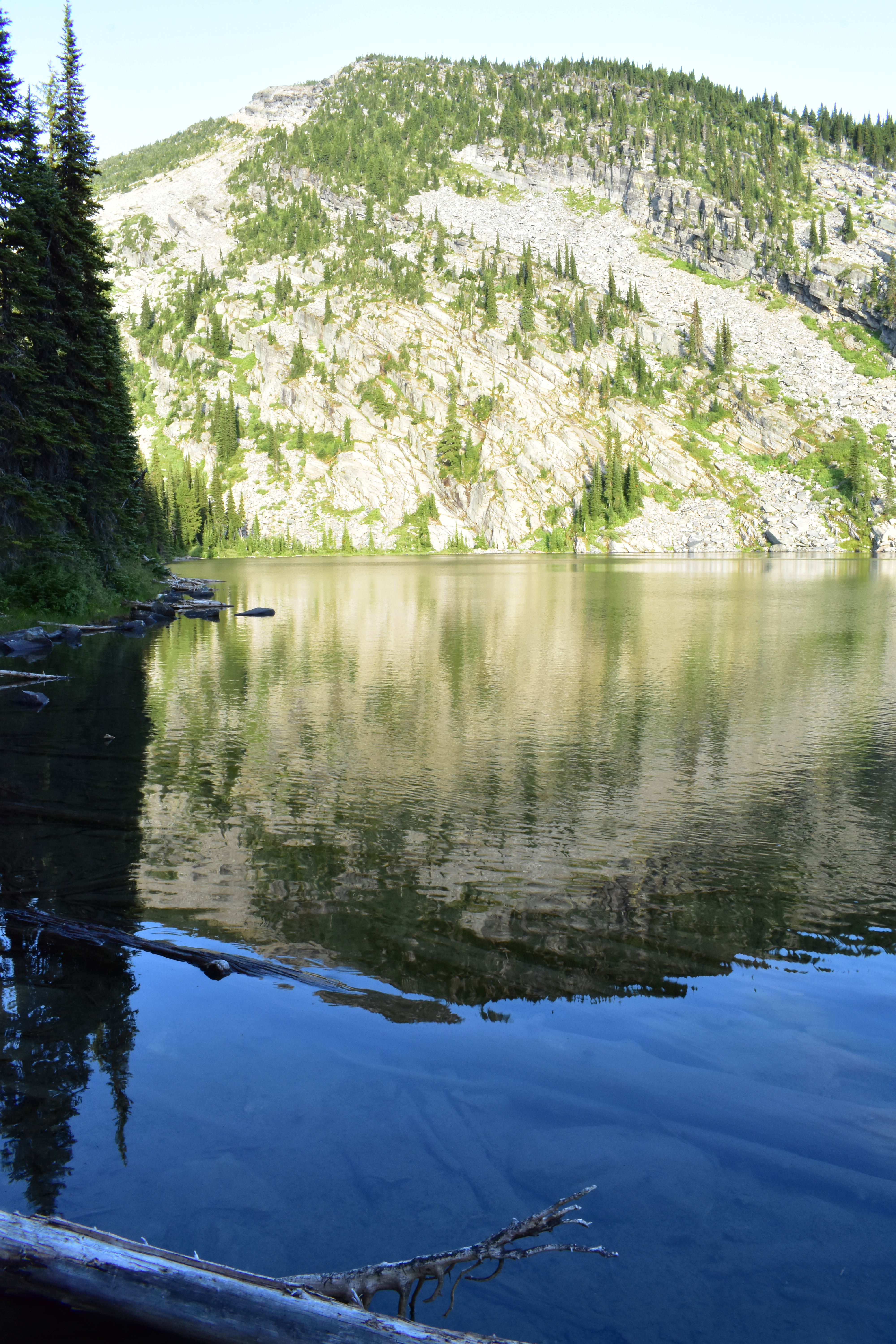
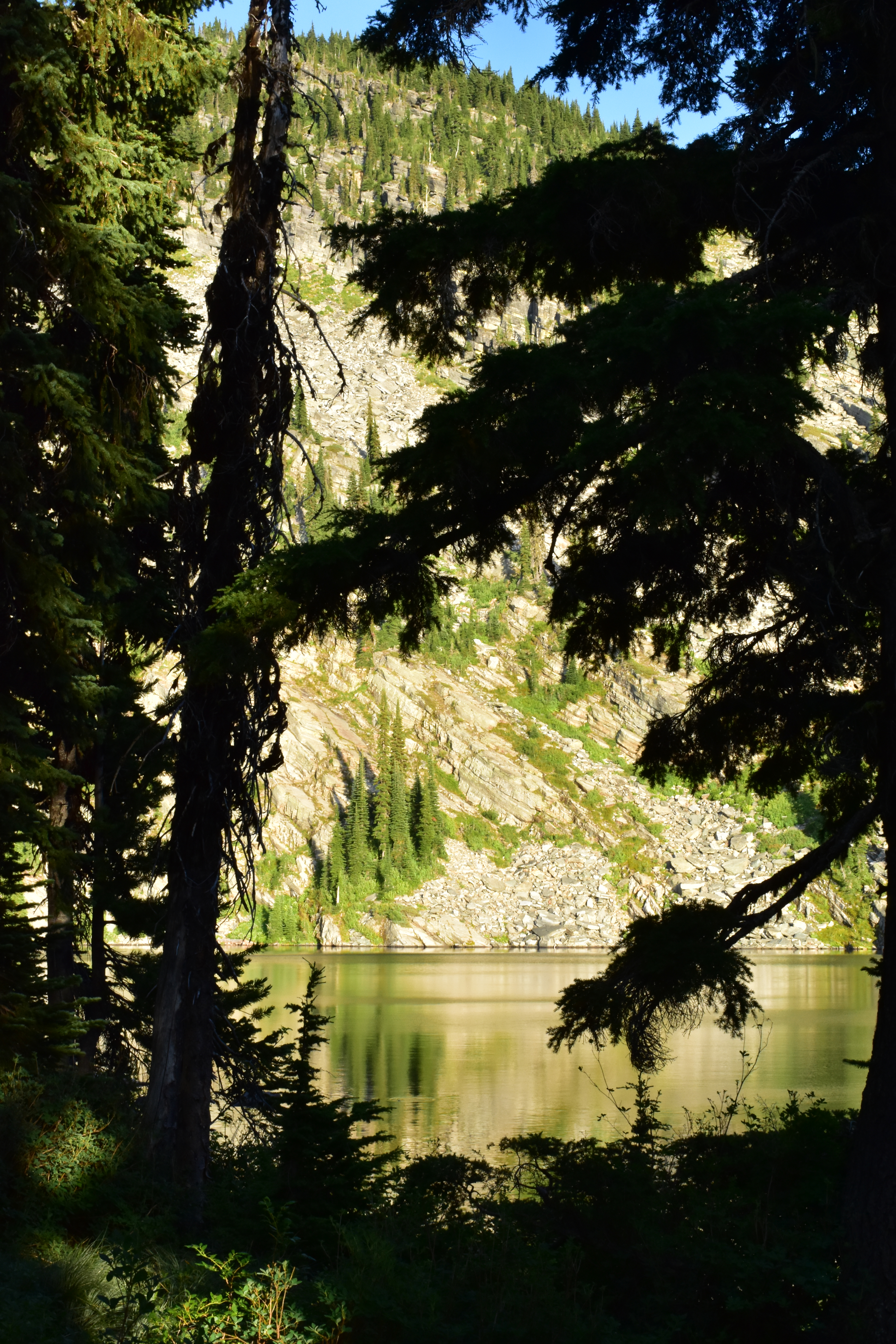
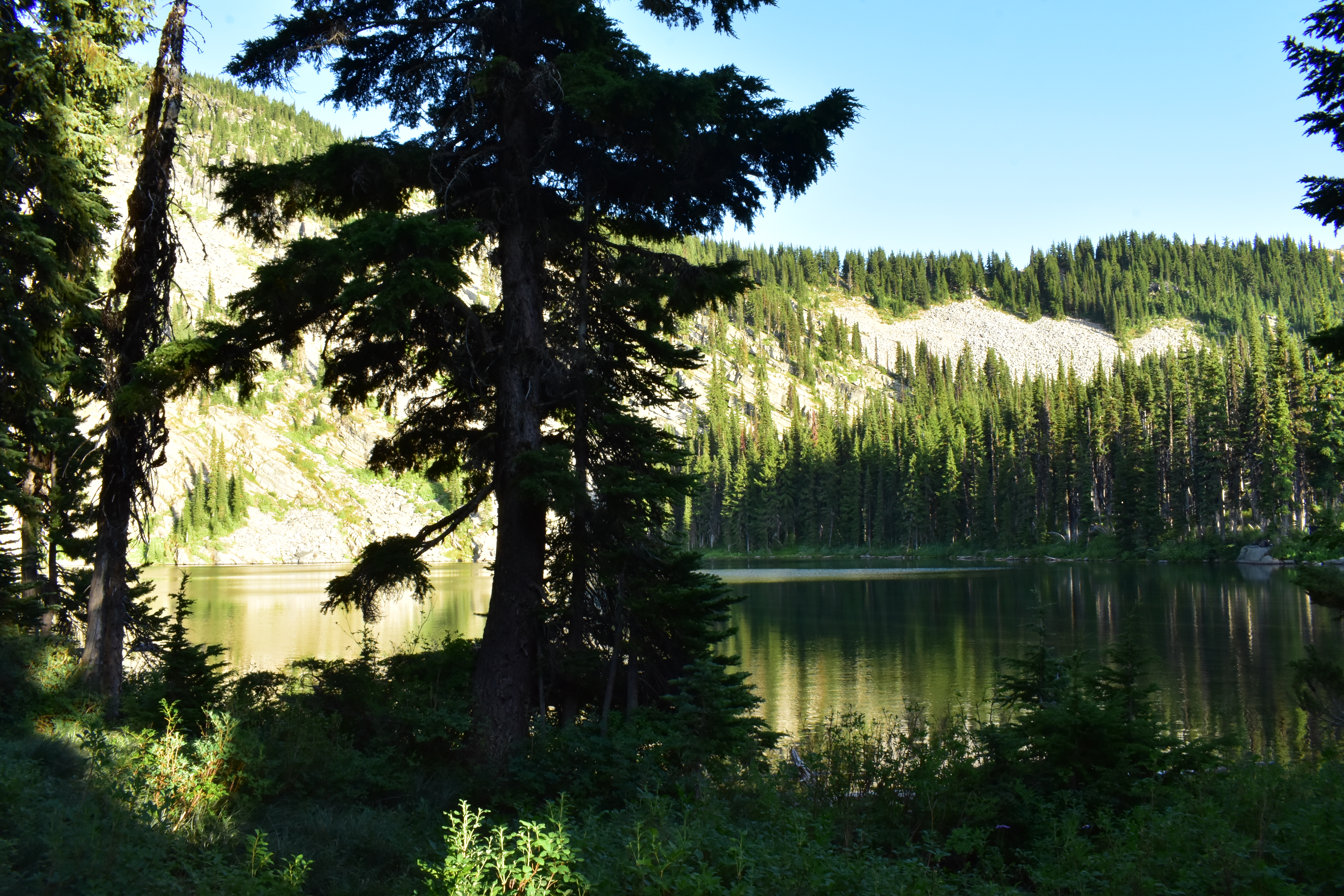
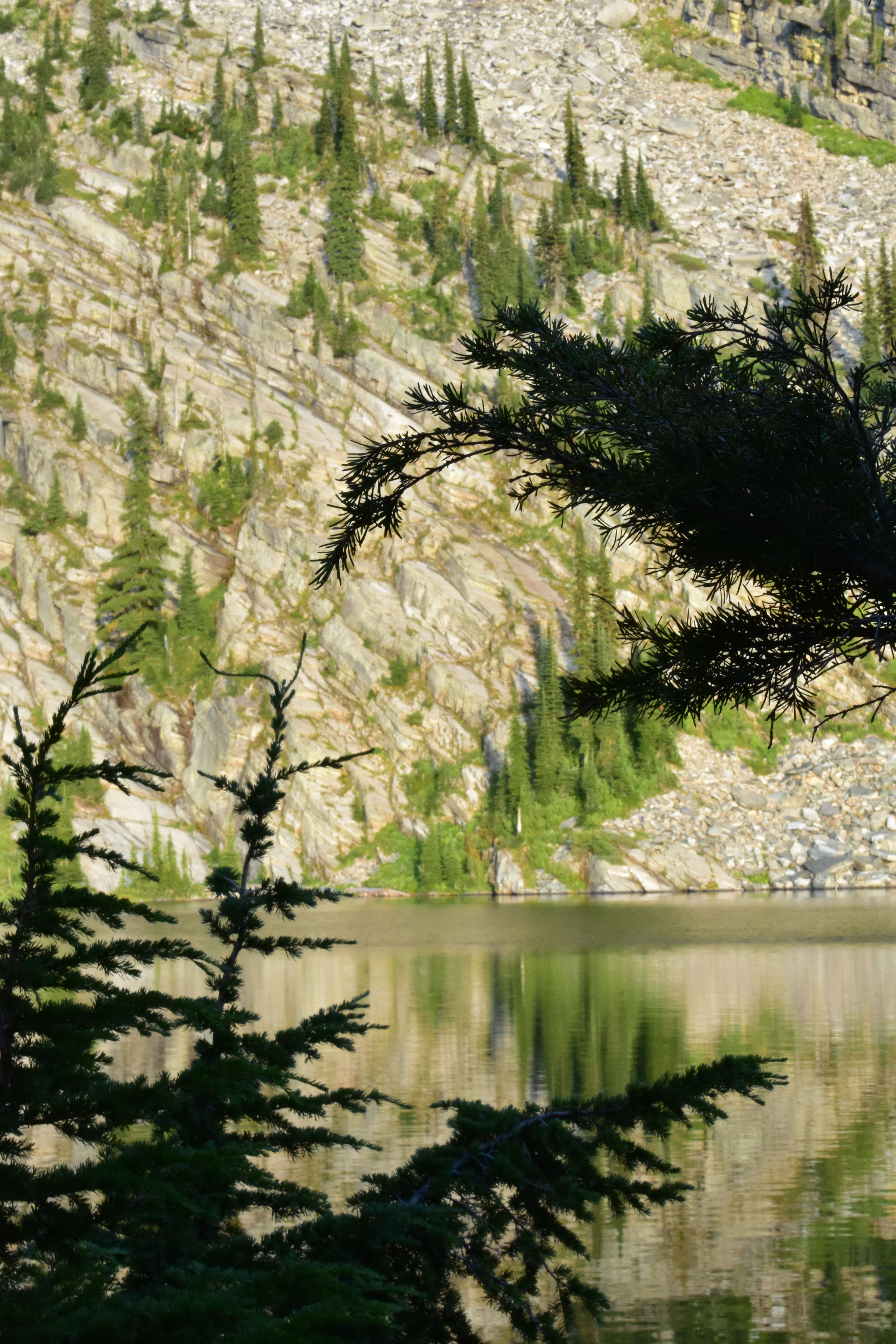
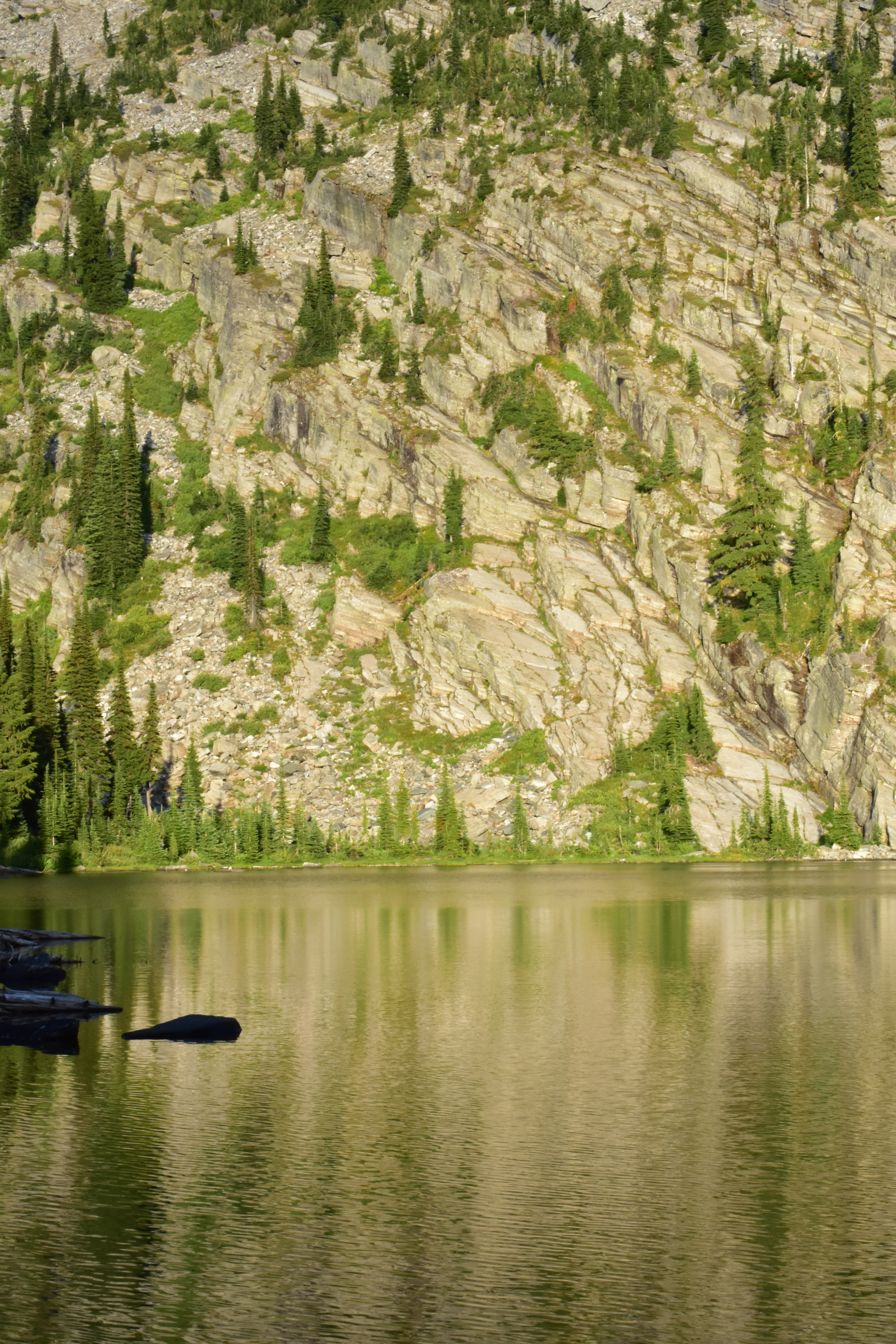
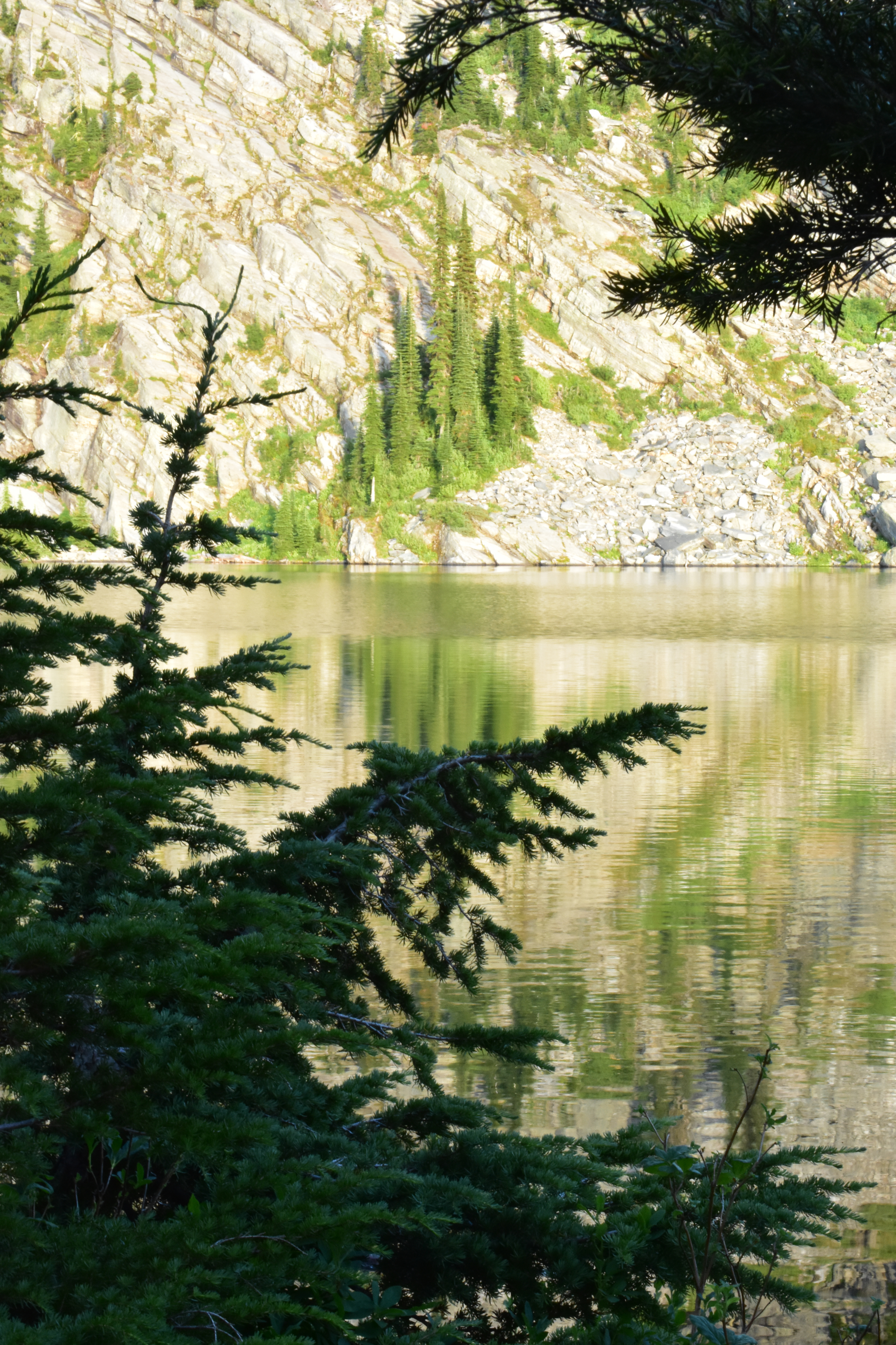
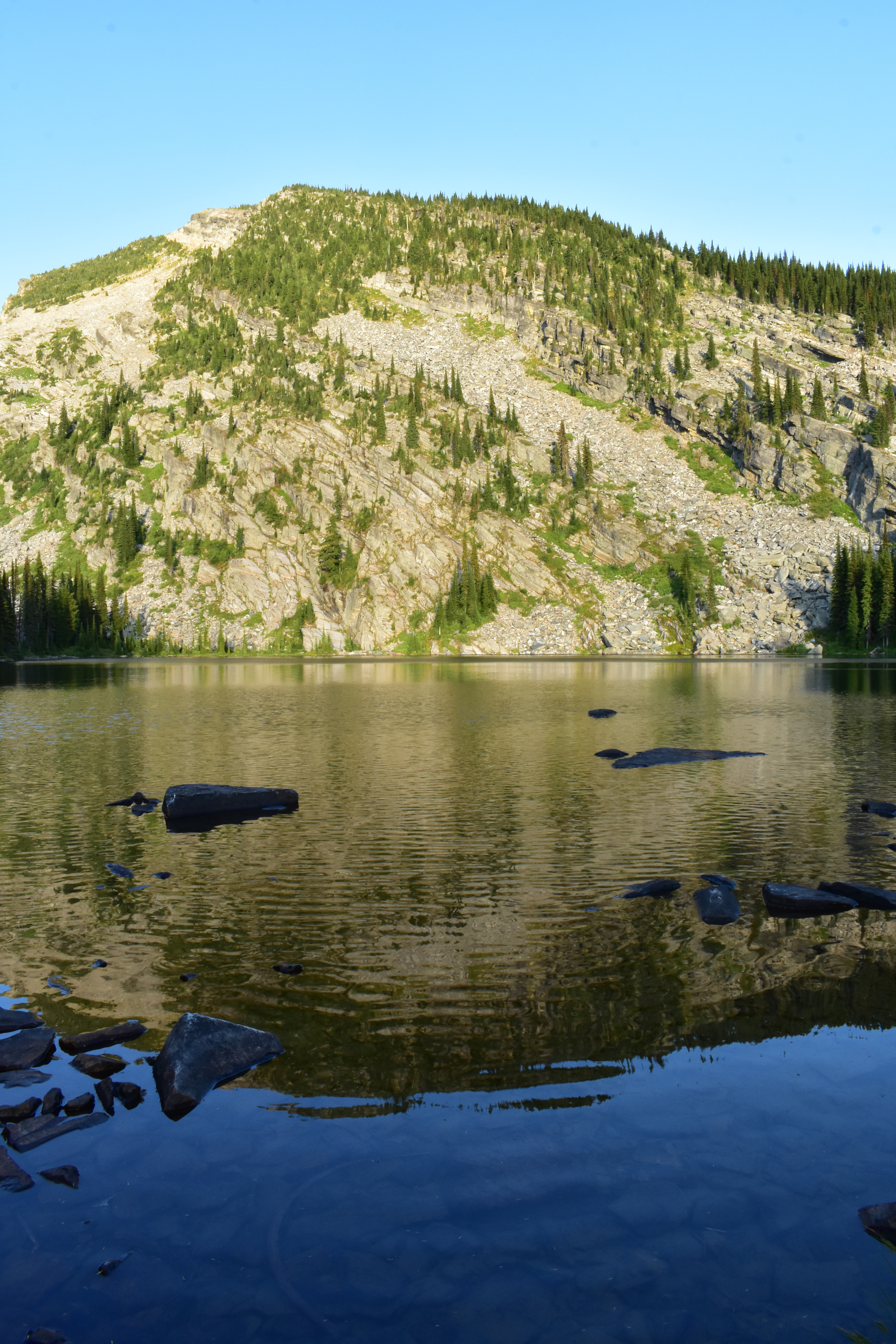
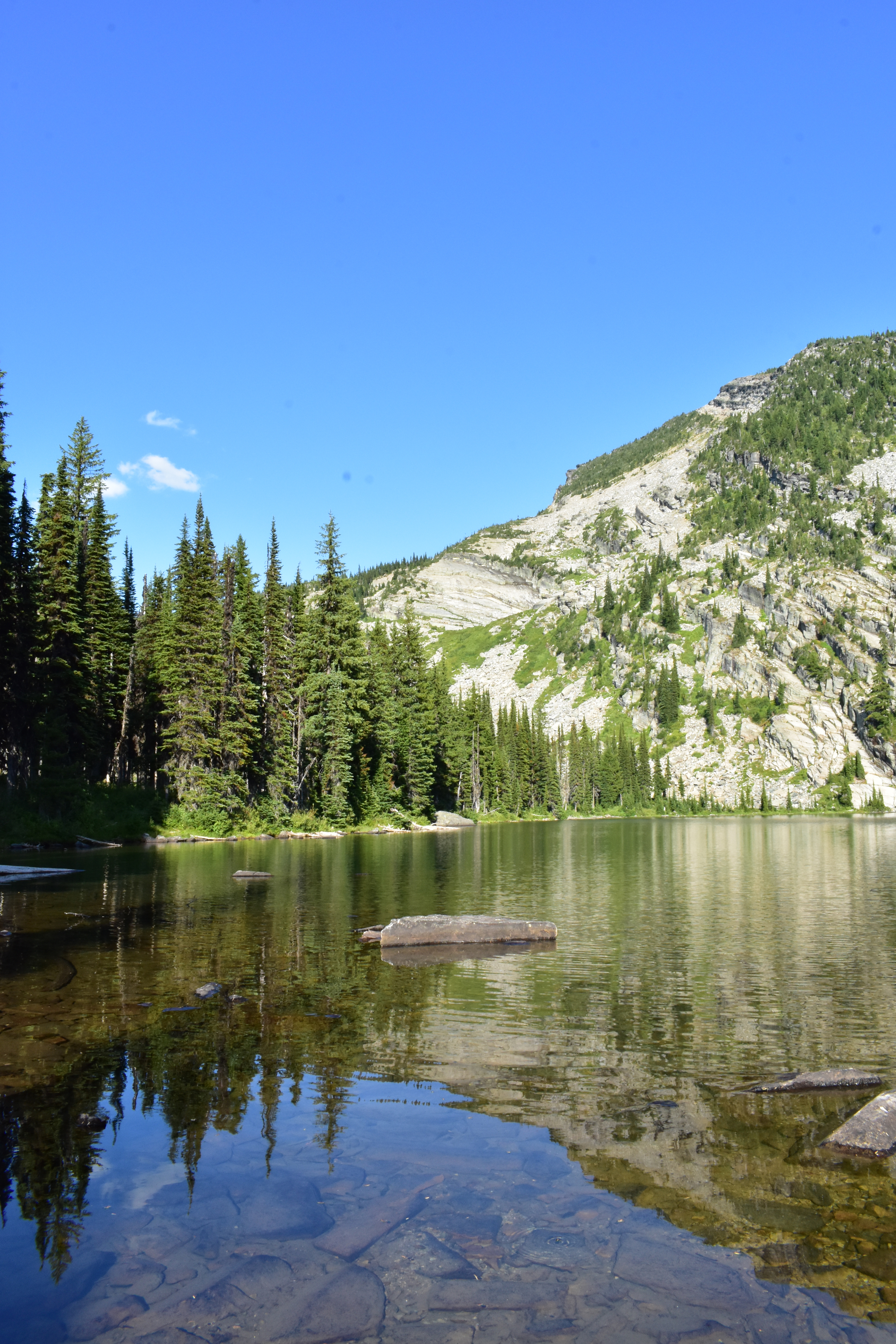
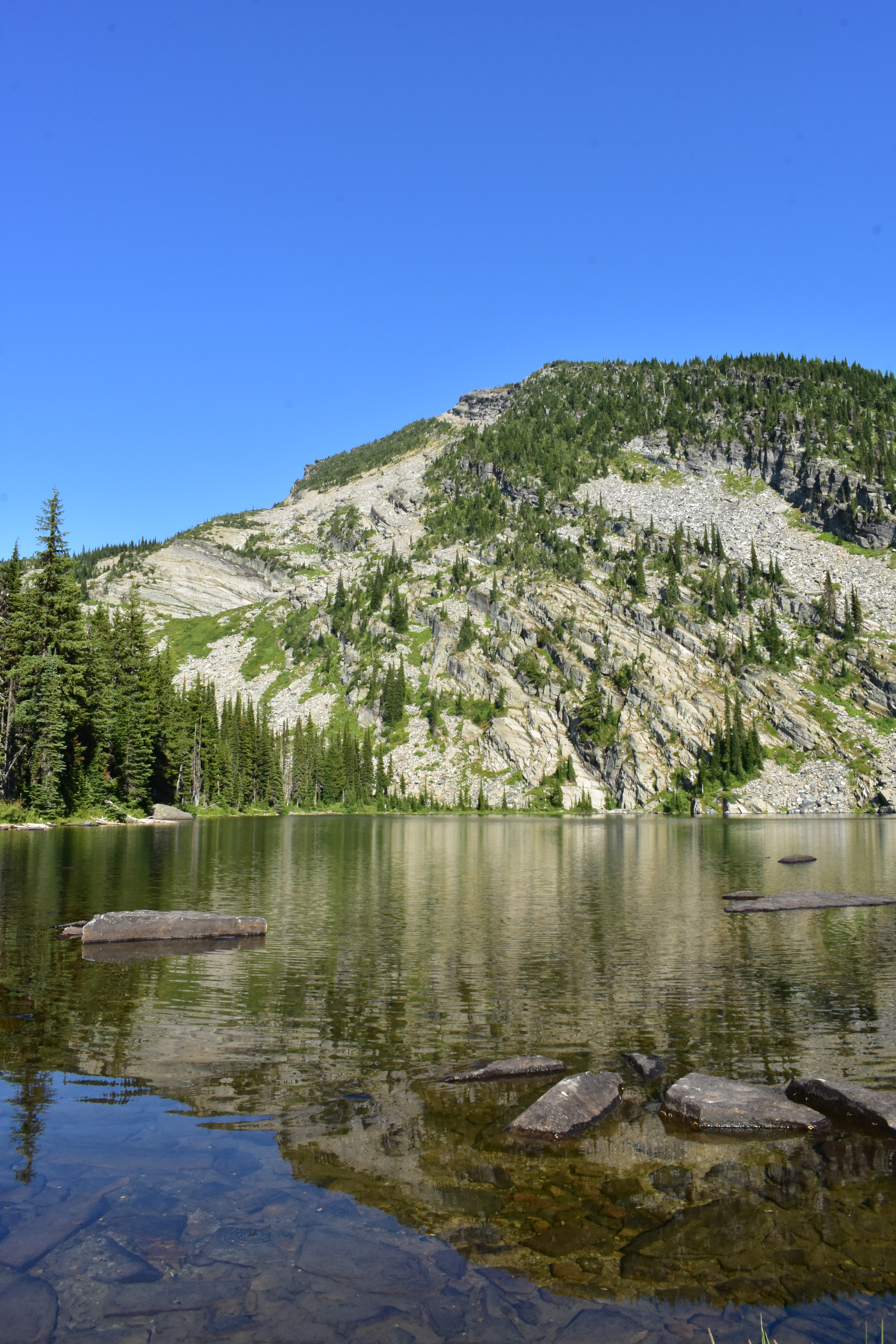
My mood improved a bit as the trail leveled and I could see the lake basin on the other side of the ridge. Beyond the basin was a spectacular wall of mountains with names emblematic of the southern Cabinets: St. Paul, Rock, Elephant, and Ojibway Peaks.

Beyond the basin was a spectacular wall of mountains. (photo by Dave)

It seemed I had put the hard part of the hike behind me and it would be a lot easier from there, but soon after that the ridge gained elevation and the trail followed steeply uphill. That's where I caught up with Dave, who was doing fine, but going slowly. Maybe it's a mental trick I haven't mastered, but I can't hike slowly. The weight of the pack makes me feel like I need to hurry and get it off my back.

So I passed Dave, but I soon was heading downhill again, away from the ridgetop, and away from the lake basin. The trail offered no visible explanation as it continued steeply downward. Watching the ridgetop recede toward the sky, I began to lose my temper, along with the precious elevation I had so painfully gained.

I yelled at the top of my lungs: "DAVE! WHY ARE WE GOING DOWNHILL?" Other than Dave, there was no one to hear me, and Dave couldn't answer the question. It was maddening. I cussed at whoever had built the damned trail.

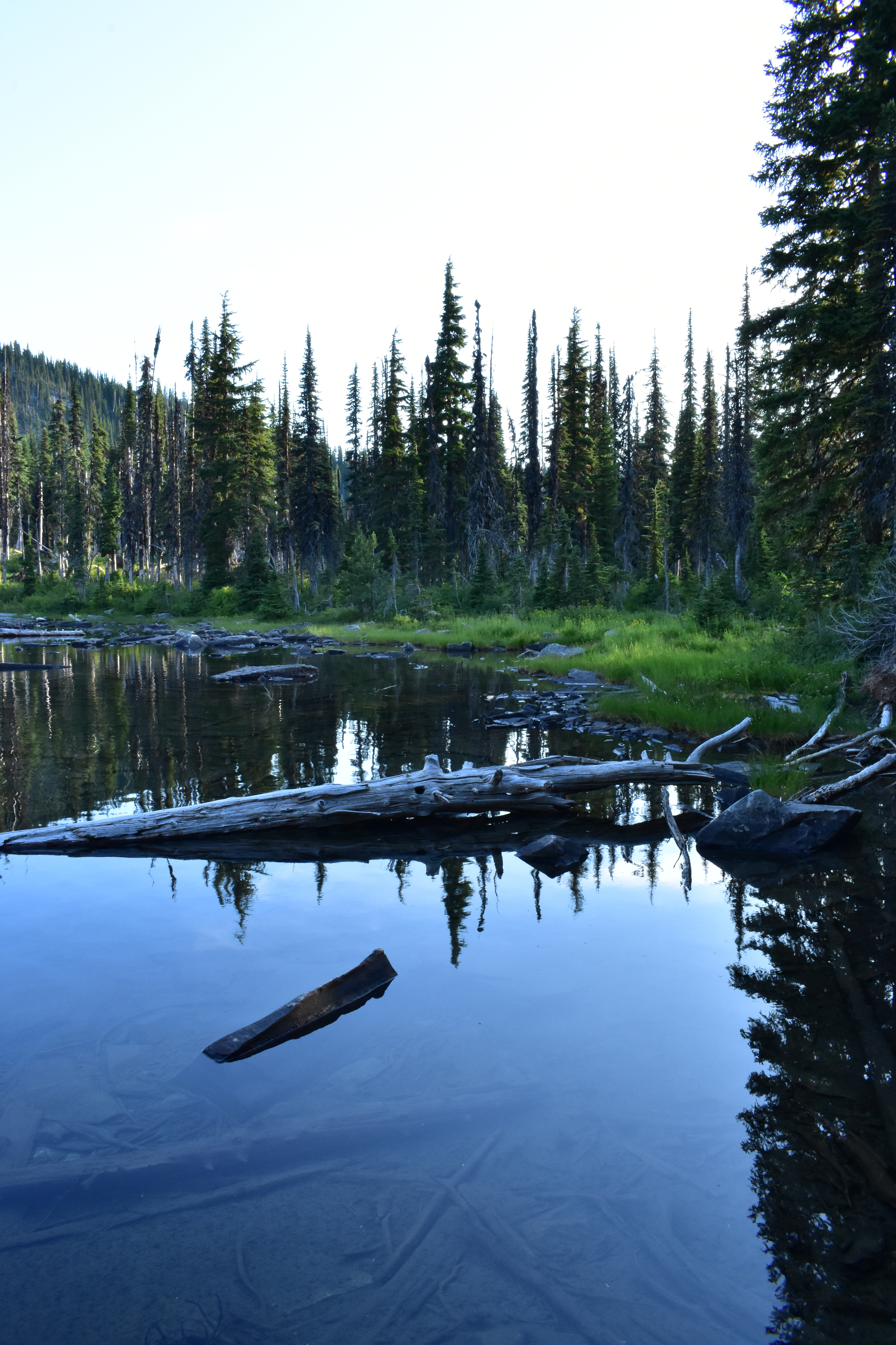
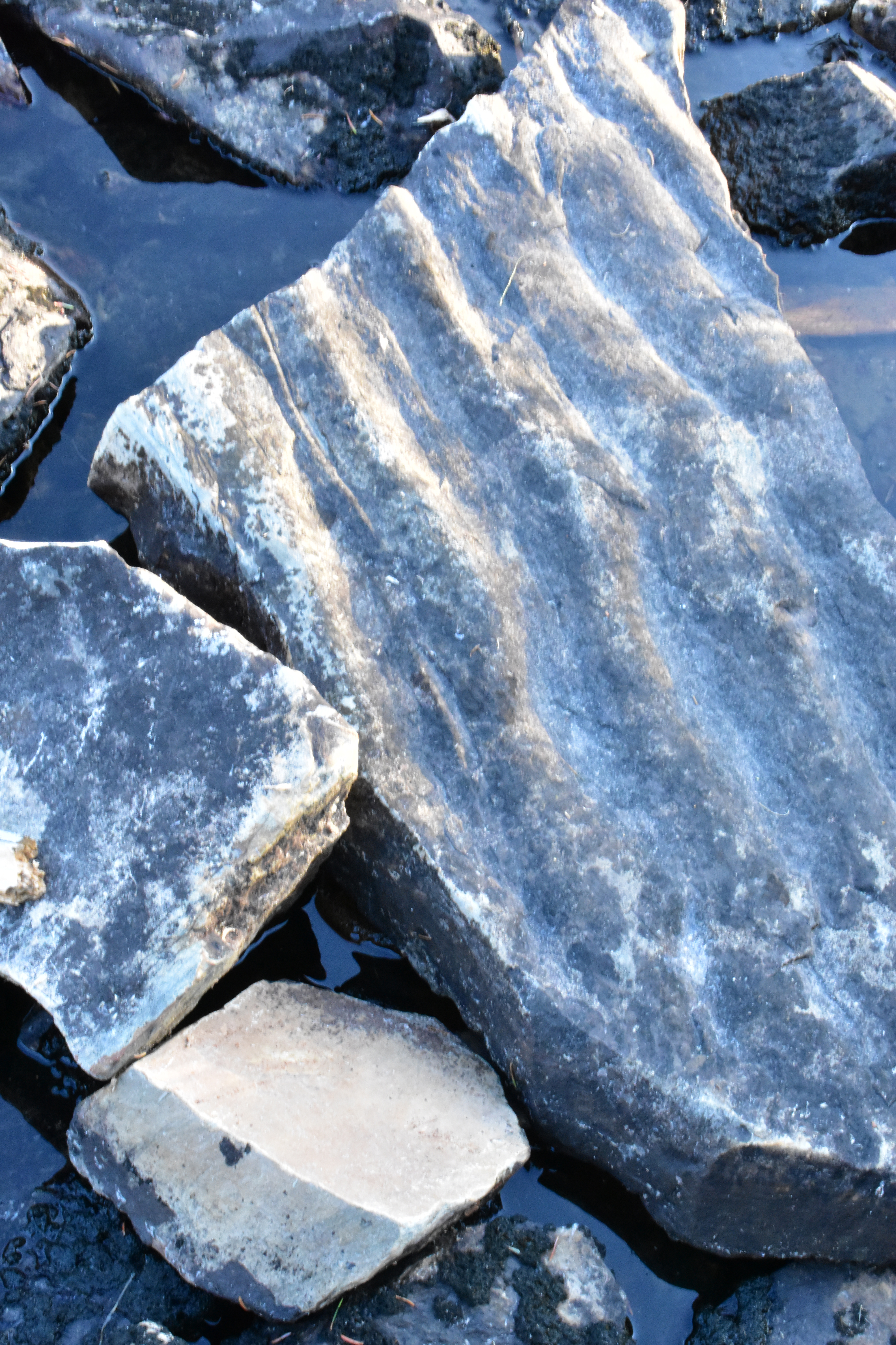
Finally, after more cussing, and climbing, and rock hopping, we reached the ridgetop, again. Then we headed steeply downhill to the lake, over another big talus slide (wear sturdy boots on this hike), and through a slowly recovering burn area of sparse trees and underbrush.

Engle Lake: July 31-August 2, 2019

Day Two

Depending on what you count as a lake, there are five to seven lakes in this basin. Normally that would indicate there were great roaming opportunities, but that wasn't the case. Although there were plenty of footpaths, all but one or two of them disappeared in the bushes after just a few yards. Also, the area had burned nearly twenty years earlier, leaving many dead trees standing among the survivors, and an ankle-trapping mesh of their fallen brethren hidden in the knee-deep brush. Much of the brush was huckleberry bushes, but the berries had not developed. Sadly, the urge to cross-country roam also did not develop.

The sky was cloudless for our entire stay and it was the start of August, so it became uncomfortably hot soon after the sun came up. Despite the heat, the combination of multiple lakes and mild temperatures earlier in the year had produced a discouraging amount of mosquitoes. The heat and the mosquitoes drove me into my tent for several hours of day two as I was still recovering from the hike in.

After resting for several hours I emerged from my tent to find it seemed cooler, and the bugs not quite as bad. Maybe I was just more acclimated, but it was a relief to feel less at war with the environment. Dave had already made his way to the deep end of the lake and was fishing. Feeling better, I made my way there to join him.

One of the footpaths that actually went somewhere circumvented the lake. It was rough and overgrown, but visible enough to follow. The way from our campsite to the other end of the lake was mostly unremarkable except for a few places you could make your way through the brush to rocks on the lakeshore big enough for sunbathing.

There was a big talus slide reaching most of the way up the mountain near the end of the lake, and a campsite at its base. Camping there would have been a more interesting experience in my opinion, but we didn't have the energy to move camp. Dave also made a good point that our campsite near the lake's outlet was better because we could easily wash our dishes downstream of the lake.

By the time I reached Dave he had already caught several beautiful, little cutthroat trout. I watched as he continued to fish. As he slowly retrieved each cast I could see the trout emerge from the shadows between big rocks deep in the cold water to investigate the bright orange lure flashing in the refracted sunlight. I couldn't tell if it triggered anger or hunger, but its pull seemed irresistible to the fish. Each time it passed they would follow the lure aggressively for several yards, apparently deciding whether to retreat or attack. Little could they realize the consequences of their dilemma.

The catch. (photo by Dave)

continue, next column

Day two gallery. Click left side of photo to go back, right side to advance.

Dave asked me if I wanted to catch a fish, then handed me the pole. After just a few casts I reeled in a nice one. Having caught enough for a meal, we strung our catch on a branch and headed back to camp.

Dave cleaned the fish and we each retreated to our cooking stations to fry up our share. It was a welcome change to eat fresh fish instead of dehydrated food. I think it gave us both a supercharge that we needed.

Later I explored a short distance down the lake's outlet. The stream was flowing very slowly but it still held a decent amount of water as it worked its way over smooth rock slabs toward the inevitable dropoff at the edge of the basin. In the calculation of reward versus effort I determined it wouldn't be worth it to go much farther downstream, but in retrospect, there might have been some nice surprises. It seems I'm just not the hiker I was thirty or forty years ago. Go figure.

At some point I remembered I should take some pictures. The urge to practice photography comes and goes for me, and it often seems like too much hassle to get the camera out of my pack. Luckily, the urge hit me a couple times on day two and Dave gave me permission to use some of his pictures here.

Engle Lake: July 31-August 2, 2019

Day Three

We discussed several plans for the third day, including ditching our packs somewhere in the woods at the top of the ridge on the hike out and following the trail uphill to the top of Engle Peak, before returning and hiking out the rest of the way. I think I suggested that plan, but I wasn't really in favor of it. I was still feeling kind of pissed off about the trail on the way in, with its unnecessary ups and downs.

I have since realized I probably should have been more forgiving in my assessment of the trail and the entire area. I didn't remember that Wanless Lake lies at the base of Engle Peak's other side. I should have known that. I used to have an almost photographic memory of the map of the Cabinets.

Wanless Lake is a full 1,000 feet lower than Engle Lake so that side of the peak would have been much more spectacular than the Engle Lake side. Had I remembered all that I might have mustered enough enthusiasm to hike to the top.

We dreaded the steep, 500 foot climb up a big talus slide from the lake to the top of the ridge on the way out. The lake is on the west side of the ridge so we could do it in the shade if we started early enough, which tipped the scales toward leaving in the morning versus hanging out and leaving later. That was probably a good idea even though the climb wasn't as bad as I had feared.

Having attained the top of the ridge, with the rest of the trail being mostly downhill, my mind shifted to thoughts of civilization. I was almost surprised to see the long view from the top with Noxon Reservoir deep in the valley in the distance. It had been just two days since I saw it on the way in, but it seemed much longer ago. Likewise with the view of the southern Cabinet peaks looking back the other way. Now, rather than lingering in awe, I felt a vague feeling of escape that pulled me onward toward the next stretch of trail, and the car.

It was fairly early when we left the lake so we had plenty of time for the drive back. It's a great, scenic drive, with a big lake along the highway near the midpoint. We stopped at a favorite old watering hole near the lake and had a couple cold draft beers and an order of fries for a total of $10(!).

continue, next column

Noxon Reservoir deep in the valley in the distance. (photo by Dave)

Since it was my last full day in Montana this summer, and Dave was agreeable to it, I decided to take the long way home: At highway 2, instead of turning east toward Libby, we went west through Troy, north up the Yaak River, and then east and south via Pipe Creek Road back to town, with a stop at the Dirty Shame Bar in Yaak.

It's a place that gives in grudgingly to change, this northwesternmost county of this most western state, but change never stops. There are visibly more people now than in my memories, and many seem to come from other places. I guess nowhere is secret anymore. Yet this little corner of Montana still feels relatively, and precariously, suspended in time. I worry for it daily.